Technical Services manages all Emergency Response Communications, call evaluations, dispatch services, public safety technology and mapping, as well as continuous improvement processes including fire accreditation and data analytics.

Areas Within Technical Services

Emergency Response Communications Centre

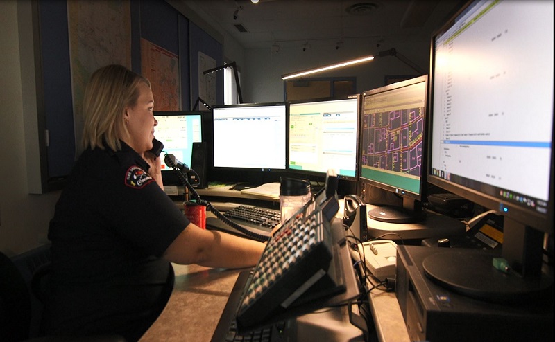
All 911 calls forwarded to Edmonton Fire Rescue Services are coordinated by the Emergency Communications Specialists at the Emergency Response Communications Centre (ERCC), commonly referred to as Dispatch Services.

ERCC's target is to evaluate a call within 60 seconds and dispatch fire crews within 30 seconds, 90% of the time.

Accreditation and Continuous Improvement

Edmonton Fire Rescue Services approaches the accreditation process as a team initiative. The accreditation process demonstrates that Edmonton Fire Rescue Services strives to be a world-class fire service through continuous improvement. It is a testimony to each member's efforts to protect life, property, and the environment while making Edmonton a safer place to live.

Edmonton Fire Rescue Services has maintained its status as an accredited agency with the Commission on Fire Accreditation International (CFAI) since March 2010. CFAI requires Edmonton Fire Rescue Services to file an annual compliance report and apply for accreditation status every 5 years.

Collecting data and turning it into useful information is important for monitoring service and making decisions based on evidence within all areas of Edmonton Fire Rescue Services. Analysts within the area use a variety of data sets to produce regularly scheduled and as needed data.

Emergency Systems

Edmonton Fire Rescue Services uses a broad range of communication and information technologies. A team of engineers and technical specialists support radios, station alerting, traffic light pre-emption, mobile data terminals, dispatch radio consoles, and more. Work is done in collaboration with the City's Open City and Technology branch to support the many software applications used.

The production of paper and electronic maps provide responding crews with information on call location, routes, closed roads, fire hydrants, building details, and more. Maps are updated regularly throughout the year as new roads and buildings are built.